To conclude our study of Frankenstein, this post will examine, with the help of StoryMapJS, the time period in which Mary Shelley created her tale. In 1816, Mary Shelley and her companions spent the summer on the shores of Lake Geneva, where the unusually gloomy weather kept them indoors much of the time. The dreary atmosphere may have fueled the group’s challenge to write ghost
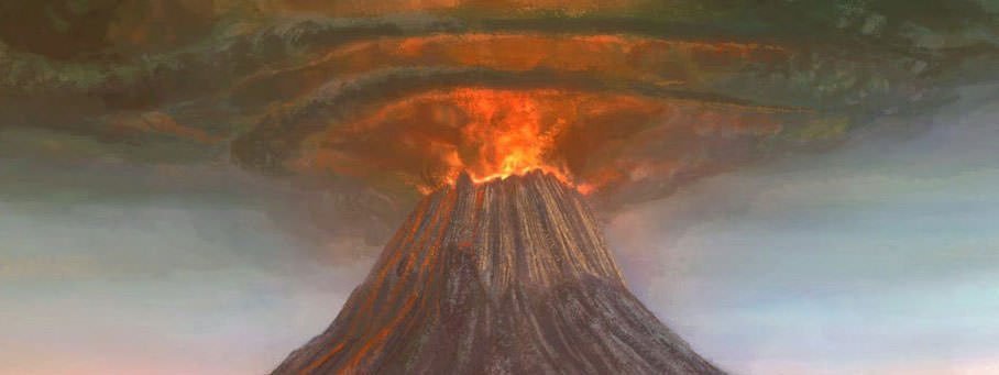
stories, but on a larger scale it was a deadly, agricultural disaster felt around the world, caused by the 1815 eruption of Mount Tambora in Dutch East Indies. This became known as The Year Without a Summer.
I’ve experimented with StoryMapJS to plot out some of the locations affected by the volcanic eruption. StoryMapJS, found at https://storymap.knightlab.com/, “is a free tool to help you tell stories on the web that highlight the locations of a series of events. It is a new tool, yet stable in our development environment, and it has a friendly authoring tool. Add a slide for each place in your story. Setting the location is as easy as a text search for the name, address, or latitude and longitude. You can enhance your StoryMap with large photographs, works of art, historic maps, and other image files, plus pull in media from a variety of sources such as Twitter, Flickr, YouTube, Vimeo, Vine, Dailymotion, Google Maps, Wikipedia, SoundCloud, Document Cloud and more.” The purpose of this experiment was to practice with the tool and see if it can be embedded into my blog. Since that was successful (WOO HOO!), I will most likely use StoryMapJS as part of my final multimodal essay due at the end of the semester. At that time I will write my own content and make better use of the ability to add various images and other files. For now, I have only added images to a few of the locations and the text was copied from the Wikipedia link below. https://en.wikipedia.org/wiki/Year_Without_a_Summer And here it should be embedded directly in the blog:
0 Comments
Leave a Reply. |
